Colorado’s recent November snowstorm brought an unusually heavy early-season snowfall to parts of the state, particularly along the Front Range. Typically, Colorado doesn’t experience such significant accumulation this early in the season, yet some areas received nearly two feet of snow. Denver International Airport saw the highest accumulation, recording 20 inches, while the Denver metro area experienced between 8 and 16 inches of snowfall. In the town of Limon, snowfall reached an impressive 35.5 inches, almost three feet, highlighting the storm’s strength.

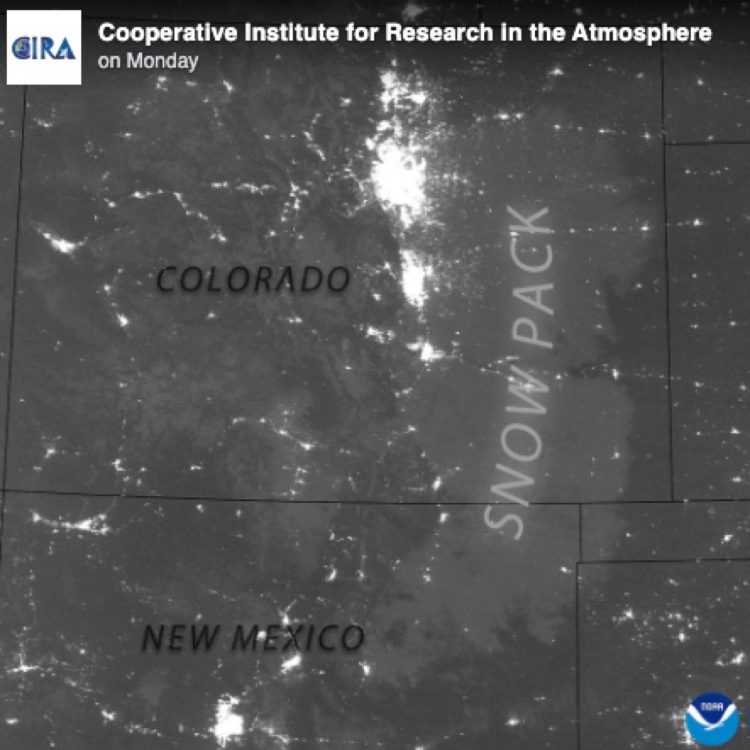
Northern Colorado was spared the brunt of the storm as it tracked further south, concentrating most of the heavy snow in the central and southern regions of the state. The snow’s intensity and coverage were so vast that the blanket of white was visible from space. The Cooperative Institute for Research in the Atmosphere shared a stunning nighttime satellite image, revealing Colorado’s snow-covered landscapes clearly illuminated by moonlight. The snow reflected light across the Front Range and eastern plains, creating a breathtaking view from above.
This early snowstorm has left many wondering if it signals a snow-heavy winter ahead. While the storm’s timing and impact suggest an active season, Colorado’s weather patterns are famously unpredictable. The snow was an impressive start to the season, but only time will tell if it foreshadows a winter filled with equally dramatic storms.


