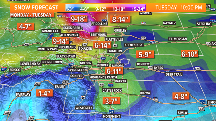
Expect a quiet morning commute on Monday, with temps in the 30s and a mix of sun and clouds. You’ll notice a gradual increase of clouds through the afternoon as our next cold front pushes through. We’ll see rain to start across the Front Range by the evening commute, but quickly transitioning over to all snow by midnight. Snow will continue Monday night into Tuesday as temps drop into the teens. Snow showers will be very heavy Monday night into Tuesday morning, impacting the Tuesday morning drive. Snow showers will start to taper off by the afternoon hours on Tuesday, with completely clear skies expected by midnight. Travel will be very difficult through the day on Tuesday as strong winds will produce blowing and drifting of snow. As for totals, the Denver metro area has the potential of seeing 5-10″ of snow by Tuesday night. 8-12″ is also forecast for the mountains and eastern plains. There will be a pocket of 6-12″ of snow possible across the far northern Front Range, primarily in portions of Larimer, Boulder and Weld counties. Travel into Wyoming on I-25 will be very difficult due to the wind and heavy snowfall. Plan accordingly and make adjustments to any travel plans if necessary.

Source: FOX 31


